
File:Southern Taal Lake.jpg
Size of this preview: 800 × 532 pixels. Other resolution: 1,048 × 697 pixels.
Original file (1,048 × 697 pixels, file size: 126 KB, MIME type: image/jpeg)
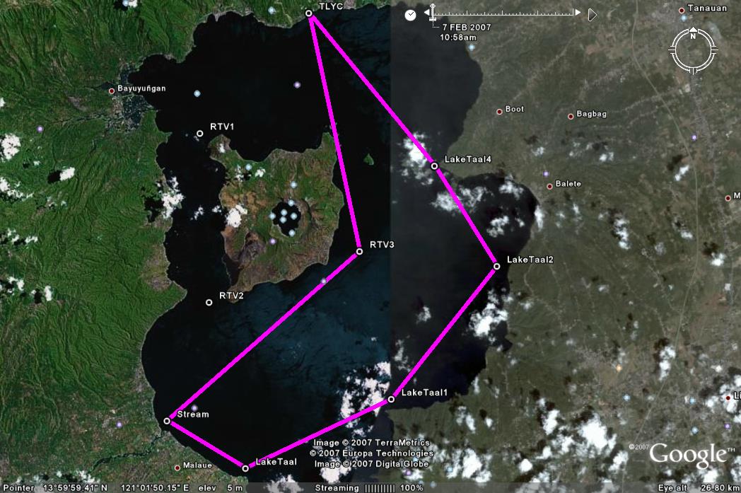
- Proposed route to visit the southern part of Taal Lake on Jan. 6, 2008.
- Leave TLYC 10am and head directly to the mouth of the Pansipit River. Find a spot there to have lunch. (Perhaps there will be some volunteers to try to sail down the river.)
- Proceed further south and then head upwind to the area where boats can park for Mt. Makulot (Lake Taal 1)
- Proceed to Lake Taal 2 and then pass through the Eastern island channel(forgot the name). I heard this passage has electrical wires but is high enough for the hobies.
File history
Click on a date/time to view the file as it appeared at that time.
| Date/Time | Thumbnail | Dimensions | User | Comment | |
|---|---|---|---|---|---|
| current | 12:34, 19 November 2007 | | 1,048 × 697 (126 KB) | Tomacruz (talk | contribs) | Proposed route to visit the southern part of Taal Lake on Jan. 6, 2008. |
You cannot overwrite this file.
File usage
The following page uses this file: